

A new high tech map of England's hedgerows has revealed Surrey and Hampshire have the lowest densities of hedgerows in the UK.
The laser scanning shows a total of 390,000 km of hedgerows (one to six metres tall) in the country.
However, while counties such as Somerset, Derbyshire and Cornwall have more than four kilometres of hedgerows per square kilometre – Surrey, Hampshire and Berkshire have fewer than two km per km2.
Hedgerows contain hundreds of plant species, provide homes for nesting birds, small mammals and insects, and capture and store large amounts of carbon.
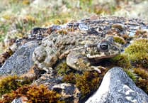 WATCH: Something to shout about as rare toad making comeback on East Hampshire estate
 Heavy rain and flooding warning after snowfall across region
 Bird-nesting season: National Trust plea to keep dogs on a short lead until August 31
 Heath Watch: Where does all the Wealden Heaths' wildlife go in the winter?
Ecologists and scientists from the UK Centre for Ecology & Hydrology hope the new map will guide planting and restoration of the vulnerable habitats.
That will support the wildlife that rely upon them – as well as mitigate the impacts of climate change.
Dr Richard Broughton, who led the map project, said: "Hedgerows are not only an intrinsic part of England's rural heritage, they can also be a real asset in helping to tackle to biodiversity and climate crises."
The data reveals the South West has the highest hedgerow count (holding 24 per cent of England's hedges) – led by Cornwall.
Excluding London, the North East has the lowest share (four per cent).
Hedgerows have been critical to the UK's rural landscape since the Bronze Age – traditionally marking out boundaries and keeping in livestock.
Though approximately half of Britain's hedgerows were lost between the 1940s and 1990s – mostly in England, due to the development and agricultural intensification.
Recent years have witnessed a new threat – a lack of maintenance, resulting in gappy hedges or overgrown lines of trees.
Previous analyses have relied on estimates scaled up from field surveys, but the new map is based on aerial laser scanning of England's entire landscape using Lidar (Light Detection and Ranging) remote sensing data.
It provides precise information on the number of hedgerows, as well as their length – and for the first time, their height measurements, which is a vital indicator of hedge quality.
Dr Broughton added: "The new map enables us to see where hedgerows are sparse and identify sites for targeted planting and restoration efforts, linking up habitats and improving the hedgerow network.
"It can also be used to estimate the potential amount of carbon that hedgerows could remove from the atmosphere and store."
The new data calculates there are 390,000 km of hedgerows in England measuring between 1 and 6 metres in height.
Additionally, there are another 67,000 km of lower hedges and a further 185,000 km of overgrown hedges above 6m tall.
The Government has pledged to support farmers to create or restore 30,000 miles of hedgerows a year by 2037 and 45,000 miles a year by 2050.
And last November, work began on the Hampshire Hedge; a rural hedgerow connecting the New Forest and South Downs with a "nature recovery corridor".
The Campaign for the Protection of Rural England (CPRE), which launched the three-year initiative with community groups and landowners to improve existing, and replace lost, hedgerows, hopes it will help "fragmented" wildlife habitats.
The hedgerow is planned to wind its way for about 14 miles (22km) through the central Hampshire parishes and link woodlands, meadows, local nature reserves and Sites of Special Scientific Interest (SSSIs).
By Lauren Beavis/SWNS
Comments
This article has no comments yet. Be the first to leave a comment.