
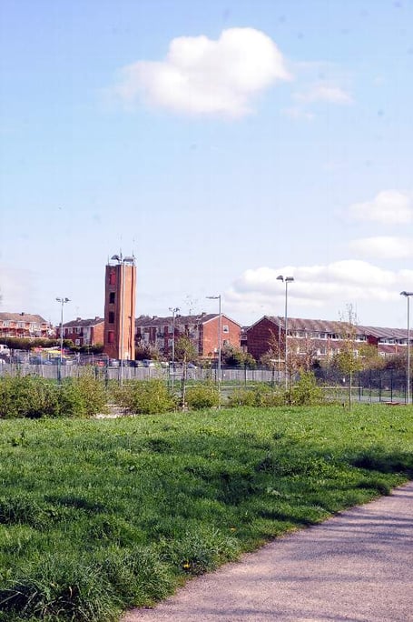
The four-and-a-half acre site, on the banks of the River Wey, currently accommodates a temporary extension to the ‘Riverside 2’ car park to compensate for a loss of parking facilities during the construction of Brightwells.
However, when this is no longer needed, Waverley has outlined plans as part of its new Local Plan to develop the car park site for other, as-yet-unspecified uses.
The council will soon launch a public consultation on the plans - but this has been delayed until May 25, due to a by-election being held in Farnham Castle after the resignation of Farnham Residents councillor John Williamson, and the requirement for Waverley to go into ‘purdah’ beforehand. Voting will take place on Thursday, May 24.




As Farnham Riverside is a flood zone, flood risk and drainage assessments must be carried out before any major development is proposed at the site.
The land could also potentially be contaminated, so an assessment of the nature and extent of any contamination would be needed. This would have to include details of any necessary remedial measures.
A transport assessment and travel plan would also be required if a major development is proposed on the site.
The proposal forms part of Waverley’s ‘Local Plan Part 2: Site Allocations and Development Management Policies’, which together with the adopted ‘Local Plan Part 1: Strategic Policies and Sites’ will replace the borough’s current Local Plan dated 2002.
While Part 1 of the Local Plan specified the overall spatial strategy for development and growth in the borough, and allocated strategic sites for a minimum of 11,210 homes up to 2031, Part 2 will provide the more detailed day-to-day planning policies and will allocate sites needed for housing or other land use needs. It will also review the boundaries of Waverley’s town centres and important local landscape designations.
Following Part 1’s adoption in February, Part 2 will now be formally consulted on after members of Waverley’s executive were given first sight of the new site allocations and development management policies in their agenda papers for last week’s meeting.
Additional sites within Farnham and the surrounding area earmarked for development in Part 2 include:
• Elstead: Land behind The Croft, land at Sunray Farm, and at Four Trees in Hookley Ln.
• Farnham: Coxbridge Business Park and Monkton Farm.
• Badshot Lea: Land south of Kiln Hall in St Georges Road, and land off Badshot Lea Road.
• Runfold: Hop Meadows in Old Bridge Rd, land east of the Willows, and the Old Stone Yard in Tongham Road.
Residents, developers and other interested parties will be asked for their views between May 25 and July 9 on the council’s preferred options on housing, settlement boundaries, local landscape designations, and gypsy and traveller accommodation.
It comes after a trio of judicial review challenges were launched against Waverley’s Local Plan Part 1 last week, by the Protect Our Waverley campaign group, the Campaign to Protect Rural England and two Milford residents.
Comments
This article has no comments yet. Be the first to leave a comment.