
PLANNING permission has finally been granted to the controversial Will Hall Farm development, after amendments to the plans met with the approval of district planners.
The Will Hall Farm site lies on the north-western edge of Alton, immediately adjacent to the Basingstoke Road. The farm incorporates a number of buildings, the most important of which is a 17th century barn which stands in the centre.
Other buildings of importance include the early 18th century farmhouse, a granary and a number of hop kilns, all of which are Grade II listed, a smaller barn with a linked stable block and a smaller lodge dwelling.
The old buildings on the site are generally in a poor state of repair and have suffered from lack of investment in recent years. A number of modern agricultural buildings are also present on the site, even though there is currently no viable agricultural activity taking place.

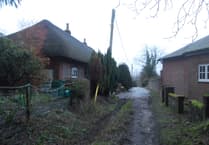

The plans propose to refurbish the old barn for light industrial business purposes; convert the small barn and stable block into two dwellings with associated parking; convert and extend the hop kilns to provide two dwellings with a new-built garage block; demolish the lodge dwelling and replace it with a new dwelling with detached garage, and demolish all the modern barns to be replaced with three new-build houses.
The farmhouse will remain unchanged to be retained as a single dwelling.
The application first went before the north planning committee on July 18, but was deferred to allow for a site visit, further information on flooding issues and further negotiations with the applicant on the scale of the new-build enabling development.
The application was again brought before the committee on September 19, but was again deferred to allow for further consultation over flooding with the Environment Agency and EHDCÕs engineering works manager.
Committee members, Alton Town Council, the Environment Agency and the engineering works manager, all had concerns about possible flooding on the site, as the complex was badly affected by the floods in the winter of 2000/2001.
Three letters of representation echoed these fears, and highlighted other concerns such as the impact on the tranquillity of the area, the possibility of development on surrounding land and traffic issues.
However, 13 letters were received that supported the proposals, saying that the plans were appropriate and sympathetic to the site.
Letters of comment were also received from the East Hampshire CyclistsÕ Forum and the Alton Friends of the Earth, asking for the provision of a cycle path along the frontage of the site. The applicant has since amended the plans to include such a path.
Following the concerns over flooding raised by members at previous meetings, the applicant, The Alton Building Preservation Trust, provided a report into land drainage and flooding issues undertaken by independent engineers at the applicantÕs cost, and a copy of the revised financial viability assessment.
The subsequent amendments made to the plans satisfied both the Environment Agency and engineering works manager over drainage issues.
Committee chairman Patrick Burridge said that with the amended plans satisfying the experts on flooding, the main issue was that of new buildings on the site.
He said: ÒThe old barn is in a shocking state, and the four oasts are even worse. These will be extremely expensive to repair in their own right, and I think that a limited amount of new building on the site is justified if it will mean that these important old buildings can be saved.Ó
He also highlighted the fact that the applicant is a body concerned with the preservation of historic buildings in the town, meaning that sympathetic new building will be of utmost concern to the applicant, not just the planning authorities.
He added: ÒThese plans maintain practical use of the barn and listed buildings, and will enhance an attractive route into the town by getting rid of unattractive agricultural buildings. And with the additional cycle path in the amended plans, I would strongly urge members to support the application.Ó
Unsurprisingly, the majority of the following debate remained on the subject of flooding. Stewart Glasgow agreed with most of what Mr Burridge had said, but still had concerns over flooding after talking to Òpeople that know about these thingsÓ.
Pam Bradford highlighted that the previous floods were the result of a blocked culvert on the site which has since been unblocked, and asked what measures would be taken to ensure that the situation stays that way.
Planning officer Chris Murray responded by saying that the new occupiers have an interest in preserving the site, and will have a management team that will keep an eye on the state of the ditches and culverts that provide the drainage on the site.
Peter Wonson asked who would be responsible if the various flooding reports were wrong and the site floods again.
Michael Lawler, EHDCÕs head of legal and democratic services, said that it would be Hampshire County CouncilÕs responsibility, and that the county has powers to enforce ditch maintenance.
Bryan Timms raised the possibility of introducing a condition requiring the applicant to contribute funds towards improving the drainage of the whole area. Mr Murray said that it would be unfair to make the developer solve other drainage problems in the town that are not the fault of the development.
He also raised the point that the proposal could only improve the drainage situation in the area, not make it worse.
EHDC planning officers had recommended that the plans be given permission, with the added stipulation that the cycle path be provided.
Members added further conditions to the plans, requesting a continual archaeological log to be kept through the development, due to the possibility that the site was once a Saxon settlement, and that a bat survey be carried out on the suggestion of English Nature.
When this motion was put to the vote, members agreed unanimously to approve the plans.